

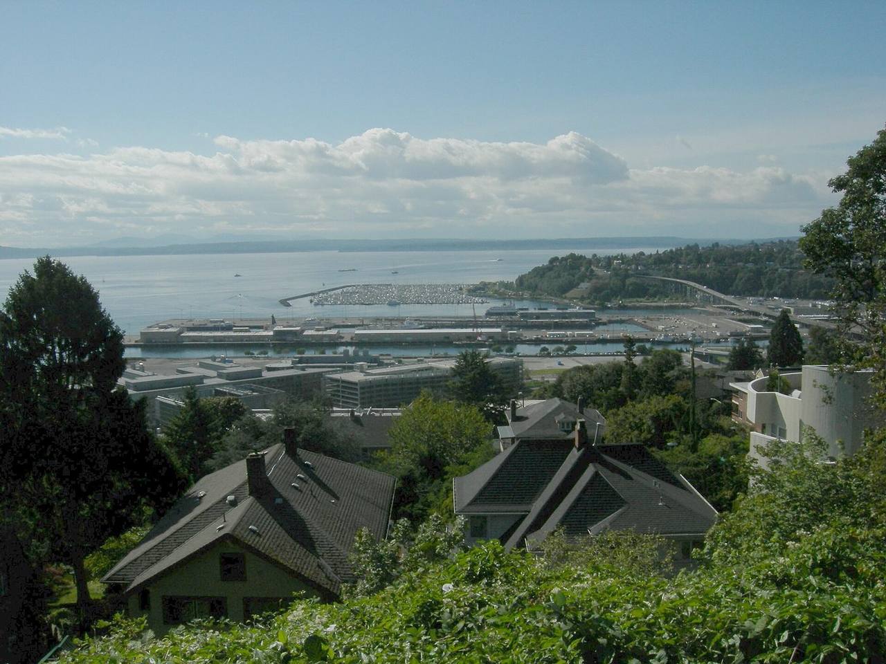
Interbay market snapshot
Over the trailing twelve months, the median Interbay home sold for about $1,375,000, up 0.2% from a year earlier. Homes here typically went under contract in about 10 days at roughly 100.0% of list price (around $633/sq ft), reflecting a brisk, seller-leaning market. These rolling 12-month figures come from the Northwest Multiple Listing Service, the regional MLS Seattle-area agents list on, as of June 2026, and cover the broader market area around Interbay rather than Interbay on its own, so for any specific home it is worth comparing recent sales on that block.
About Interbay
Interbay is a neighborhood in northwestern Seattle that occupies the valley between Queen Anne Hill to the east and Magnolia to the west, together with the filled-in areas of Smith Cove and Salmon Bay. It is bounded on the north by Salmon Bay and the Lake Washington Ship Canal, on the south by Smith Cove (an inlet of Elliott Bay), on the east by 15th Avenue West and Elliott Avenue West, and on the west by the BNSF Railway line.
The area was originally settled as "Boulevard" by Henry A. Smith and was renamed Interbay by the mid-1890s. Rail arrived early, and construction of the Lake Washington Ship Canal in the 1910s added roughly 150 acres of filled tideland. Interbay remains predominantly industrial and maritime in character, and residential uses occupy a comparatively small share of the neighborhood.
Want to know what your money actually buys in Interbay right now?
Book a call and I'll tell you what I'd doHousing & homes
Interbay's residential base is small relative to its industrial footprint, and much of the housing is concentrated along the neighborhood's eastern and northern edges near 15th Avenue West and West Dravus Street. In recent decades this corridor has seen newer multifamily construction, and the local inventory is weighted toward apartments, condominiums, and townhomes rather than detached single-family homes.
Older residential fabric survives at the margins, including the early 20th-century houses of the Fourteenth Avenue West group near Smith Cove. Buyers looking for traditional detached homes generally find larger concentrations on the adjacent slopes of Queen Anne Hill and Magnolia, which frame the valley on either side.
Local conditions to know
Interbay sits on low ground, and substantial portions of the neighborhood occupy artificial fill and reclaimed tideland at Smith Cove and Salmon Bay. Published seismic hazard work identifies Interbay as one of the Seattle districts with elevated liquefaction potential in a Seattle Fault Zone earthquake, a characteristic tied to that fill and to alluvial soils. Buyers should factor geotechnical and structural due diligence into their process, and both buyers and sellers should confirm a specific parcel's FEMA flood designation, since shoreline and filled-lowland sites can carry flood-zone considerations. Salmon Bay water levels are regulated by the Hiram M. Chittenden Locks.
Transit access is a defining feature. The Sound Transit Ballard Link Extension is planned to run through the corridor, with a planned elevated Interbay station above 15th Avenue West near West Dravus Street and a planned Smith Cove station near the Magnolia Bridge; Sound Transit has scheduled the extension to open in 2039, and station design alternatives were still being studied as of the most recent public materials. The neighborhood is also crossed by the Ballard Bridge and the Magnolia Bridge and by active BNSF freight rail.
Getting around & local texture
Interbay is anchored by working waterfront and maritime infrastructure. The Port of Seattle operates Fishermen's Terminal on Salmon Bay and Terminal 91 at Smith Cove, a 210-acre site used for cruise operations and vessel moorage. Expedia Group's headquarters occupies the former Amgen waterfront campus on Elliott Avenue. The BNSF Railway's Balmer Yard and its locomotive maintenance shops sit at the center of the valley.
Public amenities include the Interbay Golf Center just south of the Ballard Bridge, the Interbay P-Patch community garden, Interbay Stadium, and a Washington Army National Guard armory. The Elliott Bay Trail runs south through Smith Cove Park toward the downtown waterfront, and commercial activity clusters along 15th Avenue West near West Dravus Street. Interbay lies within the Seattle Public Schools district; Seattle Public Schools assigns homes to attendance-area schools by address, and Lawton Elementary is cited as the neighborhood's attendance-area elementary school. Confirm current boundaries with Seattle Public Schools for any specific address.
What buyers & sellers weigh in Interbay
- Much of the neighborhood sits on artificial fill and reclaimed tideland with elevated liquefaction potential, so budget for geotechnical and structural inspections.
- Confirm each parcel's FEMA flood-zone status, since low-lying and shoreline sites can affect insurance and financing.
- The residential inventory skews toward condominiums, townhomes, and apartments rather than detached single-family homes.
- The planned Ballard Link Extension (targeted for 2039) includes a planned Interbay station near 15th Avenue West and West Dravus; verify station siting and any construction impacts for a given property.
- Industrial, rail, and Port operations are close neighbors; review noise, freight-rail activity, and zoning of adjacent parcels.
- Proximity to Expedia Group's campus and the downtown waterfront trail shapes local commuting and demand patterns.
What makes Interbay distinct
- A predominantly industrial and maritime valley, unlike the residential hillsides of neighboring Queen Anne and Magnolia.
- Home to major Port of Seattle facilities, including Fishermen's Terminal and the Terminal 91 cruise site.
- Location of Expedia Group's headquarters on the former Amgen Elliott Bay campus.
- A planned Ballard Link light-rail corridor with a planned Interbay station is set to change access in the neighborhood.
- Built substantially on filled tideland, which drives its geotechnical and flood-review profile.
Services in Interbay
Interbay real estate FAQ
Where is Interbay located within Seattle?
Interbay is the low valley between Queen Anne Hill and Magnolia in northwestern Seattle, extending across the filled areas of Smith Cove and Salmon Bay. It is bounded by Salmon Bay and the Ship Canal to the north, Smith Cove to the south, 15th and Elliott Avenues West to the east, and the BNSF Railway to the west.
What kind of housing does Interbay have?
The residential base is relatively small and concentrated near the eastern and northern edges of the neighborhood. It is weighted toward apartments, condominiums, and townhomes, with newer multifamily construction along the 15th Avenue West and West Dravus corridor. Detached single-family homes are more common on the adjacent Queen Anne and Magnolia slopes.
Is light rail coming to Interbay?
Sound Transit's Ballard Link Extension is planned to run through the corridor with a planned elevated Interbay station near 15th Avenue West and West Dravus Street. Sound Transit has scheduled the extension to open in 2039, and station design alternatives were still under study in recent public materials, so confirm current plans for any specific property.
Which school district serves Interbay?
Interbay is within the Seattle Public Schools district. Seattle Public Schools assigns homes to attendance-area schools by address; Lawton Elementary is cited as the neighborhood's attendance-area elementary school. Confirm current attendance boundaries with Seattle Public Schools for a specific address.
Sources & data
- Interbay, Seattle - Wikipedia
- Seattle Neighborhoods: Interbay Thumbnail History - HistoryLink.org
- Ballard Link Extension - Sound Transit
- Ballard Link Extension - Wikipedia
- Fishermen's Terminal - Port of Seattle
- Terminal 91 - Port of Seattle
- Forecasting liquefaction hazard from Seattle fault zone earthquakes (Natural Hazards, Springer)
- Expedia $900M Seattle waterfront campus - GeekWire
- Lawton Elementary - Seattle Public Schools
- Find Your School - Seattle Public Schools
- Interbay Golf Center
- Floodplain Development Code - Seattle SDCI