

Fremont market snapshot
Over the trailing twelve months, the median Fremont home sold for about $980,000, up 2.1% from a year earlier. Homes here typically went under contract in about 7 days at roughly 100.0% of list price (around $571/sq ft), reflecting a brisk, seller-leaning market. These rolling 12-month figures come from the Northwest Multiple Listing Service, the regional MLS Seattle-area agents list on, as of June 2026, and cover the broader market area around Fremont rather than Fremont on its own, so for any specific home it is worth comparing recent sales on that block.
About Fremont
Fremont sits in north-central Seattle, just north of the Lake Washington Ship Canal and the Fremont Cut. Its informal boundaries run from the Ship Canal on the south to N. 50th Street on the north, and from Stone Way N. on the east to 8th Avenue N.W. on the west, placing it between Queen Anne to the south, Ballard to the west, Phinney Ridge to the north, and Wallingford to the east.
The neighborhood was platted in 1888 and annexed to Seattle in 1891, taking its name from Fremont, Nebraska, the hometown of two of its founders. Early industry clustered along the waterfront, and in later decades Fremont drew an arts and counterculture community that shaped its present identity as a walkable commercial and residential district.
Want to know what your money actually buys in Fremont right now?
Book a 30-minute buying callHousing & homes
Fremont's residential fabric leans heavily on early-20th-century housing, with Craftsman bungalows a defining style alongside other homes from the neighborhood's early platting era. The wider ZIP 98103 area shares this mix of vintage single-family homes.
The housing stock is not uniform: contemporary infill homes, townhouses, and condominiums appear throughout Fremont, and there are floating homes on the water near the Aurora Bridge. Buyers will find everything from restored period bungalows to newer attached and multi-unit construction, which means condition, era, and property type vary widely from block to block.
Local conditions to know
Fremont fronts the Lake Washington Ship Canal, so shoreline location matters here: waterfront and near-water parcels can carry different regulatory and insurance considerations than inland lots, and you should confirm any specific parcel against the FEMA Flood Map Service Center rather than assuming. Much of Seattle's low-lying, near-water ground also falls within mapped liquefaction and steep-slope hazard areas, and Fremont's terrain rises from the canal toward Phinney Ridge, so seismic and slope conditions are worth checking parcel by parcel using the city's hazard mapping.
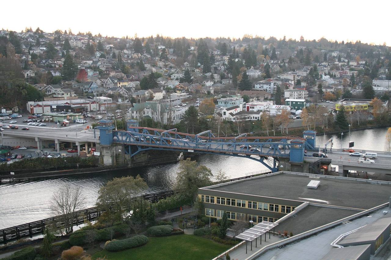
For transit, Fremont is served by King County Metro bus routes, including the RapidRide E Line on the State Route 99 (Aurora Avenue N) corridor that crosses the Aurora Bridge; there is no Link light rail station in Fremont itself. The Fremont Bridge, a 1917 double-leaf bascule bridge over the Ship Canal, is the most frequently opened drawbridge in the United States, so bridge openings are a normal part of getting in and out of the neighborhood.
Getting around & local texture
Fremont's commercial core runs along Fremont Avenue N and the streets near the Ship Canal, mixing independent shops, restaurants, and breweries such as Fremont Brewing. The neighborhood is known for public art and landmarks, including the Fremont Troll under the Aurora Bridge, the salvaged Statue of Lenin, the Fremont Rocket, and the "Waiting for the Interurban" sculpture. Employers with a Fremont presence have included Adobe, Google, the Allen Institute for Brain Science, and Tableau.
Green space includes Fremont Peak Park, B.F. Day's surrounding streets, and nearby Gas Works Park on the north shore of Lake Union, with the Burke-Gilman Trail passing through the area along the canal. Fremont is served by Seattle Public Schools; Benjamin Franklin Day Elementary is located within the neighborhood at 3921 Linden Ave. N. Attendance-area assignments are set by address, so confirm the specific school for any home using the Seattle Public Schools address lookup.
What buyers & sellers weigh in Fremont
- Verify each parcel against the FEMA Flood Map Service Center if it is near the Ship Canal shoreline.
- Check the city's hazard maps for liquefaction and steep-slope designations, especially on lots between the canal and the ridge.
- Housing varies widely by era and type, so budget for inspections that address both vintage bungalows and newer townhouse or condo construction.
- Confirm the assigned Seattle Public Schools attendance area by address rather than assuming a neighborhood default.
- Factor Fremont Bridge openings into commute and access expectations for canal-adjacent locations.
- For floating homes or waterfront property, allow extra time for specialized financing, moorage, and insurance review.
What makes Fremont distinct
- Fremont fronts the Lake Washington Ship Canal and the Fremont Cut, giving it waterfront and floating-home options that most neighboring areas lack.
- It anchors a dense, walkable commercial district with breweries, shops, and well-known public art landmarks.
- The 1917 Fremont Bridge, the most frequently opened drawbridge in the U.S., is a distinctive daily feature of the neighborhood.
- Fremont has hosted major technology employers such as Adobe, Google, and the Allen Institute for Brain Science.
Services in Fremont
Fremont real estate FAQ
What kinds of homes are common in Fremont?
Fremont's stock is anchored by early-20th-century housing, with Craftsman bungalows a defining style, alongside contemporary infill homes, townhouses, condominiums, and even floating homes near the Aurora Bridge. Property type and condition vary considerably from block to block.
How do you get around Fremont without light rail?
Fremont is served by King County Metro bus routes, including the RapidRide E Line along the State Route 99 (Aurora Avenue N) corridor over the Aurora Bridge. There is no Link light rail station in Fremont itself. The Burke-Gilman Trail also runs through the area along the Ship Canal.
Which school district serves Fremont?
Fremont is served by Seattle Public Schools. Benjamin Franklin Day Elementary is located in the neighborhood at 3921 Linden Ave. N. Because attendance areas are assigned by address, confirm the specific school for any home using the district's address lookup tool.
Sources & data
- Fremont, Seattle - Wikipedia
- Fremont Bridge (Seattle) - Wikipedia
- Aurora Bridge - Wikipedia
- King County Metro RapidRide E Line
- FEMA Flood Map Service Center
- Seattle Hazard Explorer (liquefaction & landslide hazards)
- Seattle Public Schools - Enrollment Planning / Attendance Area Maps
- Benjamin Franklin Day Elementary - Seattle Public Schools
- NWMLS residential market statistics (rolling 12-month)