

Wallingford market snapshot
Over the trailing twelve months, the median Wallingford home sold for about $980,000, up 2.1% from a year earlier. Homes here typically went under contract in about 7 days at roughly 100.0% of list price (around $571/sq ft), reflecting a brisk, seller-leaning market. These rolling 12-month figures come from the Northwest Multiple Listing Service, the regional MLS Seattle-area agents list on, as of June 2026, and cover the broader market area around Wallingford rather than Wallingford on its own, so for any specific home it is worth comparing recent sales on that block.
About Wallingford
Wallingford is a residential neighborhood in north-central Seattle, sitting on a hill above the north shore of Lake Union roughly four miles from downtown. Its generally accepted boundaries are Aurora Avenue North to the west, Interstate 5 to the east, Lake Union to the south, and North 50th Street to the north, though the western and northern edges are sometimes debated with neighboring Fremont and Green Lake. The neighborhood falls within the 98103 ZIP code.
Want to know what your money actually buys in Wallingford right now?
Talk it through before you writeHousing & homes
Wallingford developed as a classic streetcar suburb after an early-1900s trolley line spurred construction, and its residential fabric still reflects that era. The neighborhood is known for its 1920s-era box houses and Craftsman bungalows on a regular grid of tree-lined streets. Detached single-family homes make up much of the housing, alongside duplexes, triplexes, rowhouses, and apartment buildings that have long been part of the neighborhood, particularly toward its southern and western edges.
A portion of the neighborhood lies within the Wallingford-Meridian Streetcar Historic District, listed on the National Register of Historic Places on December 9, 2022. The district covers hundreds of single-family homes and dozens of multifamily buildings roughly between North 46th and North 50th Streets. If you are considering a home inside those boundaries, it is worth understanding how the historic designation may affect exterior alterations before you write an offer or plan a remodel.
Local conditions to know
Wallingford's southern edge meets the Lake Union shoreline at Gas Works Park, which includes regulated shoreline frontage. Filled and low-lying ground near shorelines in Seattle can fall within the city's mapped liquefaction-prone areas, so for any property close to the lake I recommend checking the City of Seattle's Environmentally Critical Areas and liquefaction mapping, along with the regional seismic hazard tools, as part of due diligence.
Much of the neighborhood occupies a ridge that slopes down toward Lake Union, so some parcels involve grade changes worth reviewing for drainage and foundation considerations. The neighborhood is bordered on the west by Aurora Avenue North (State Route 99), a major arterial served by frequent transit, which is a factor to weigh for properties near that corridor. Confirm any specific flood, steep-slope, or critical-area designations for a given address using the city's official GIS layers before relying on them.
Getting around & local texture
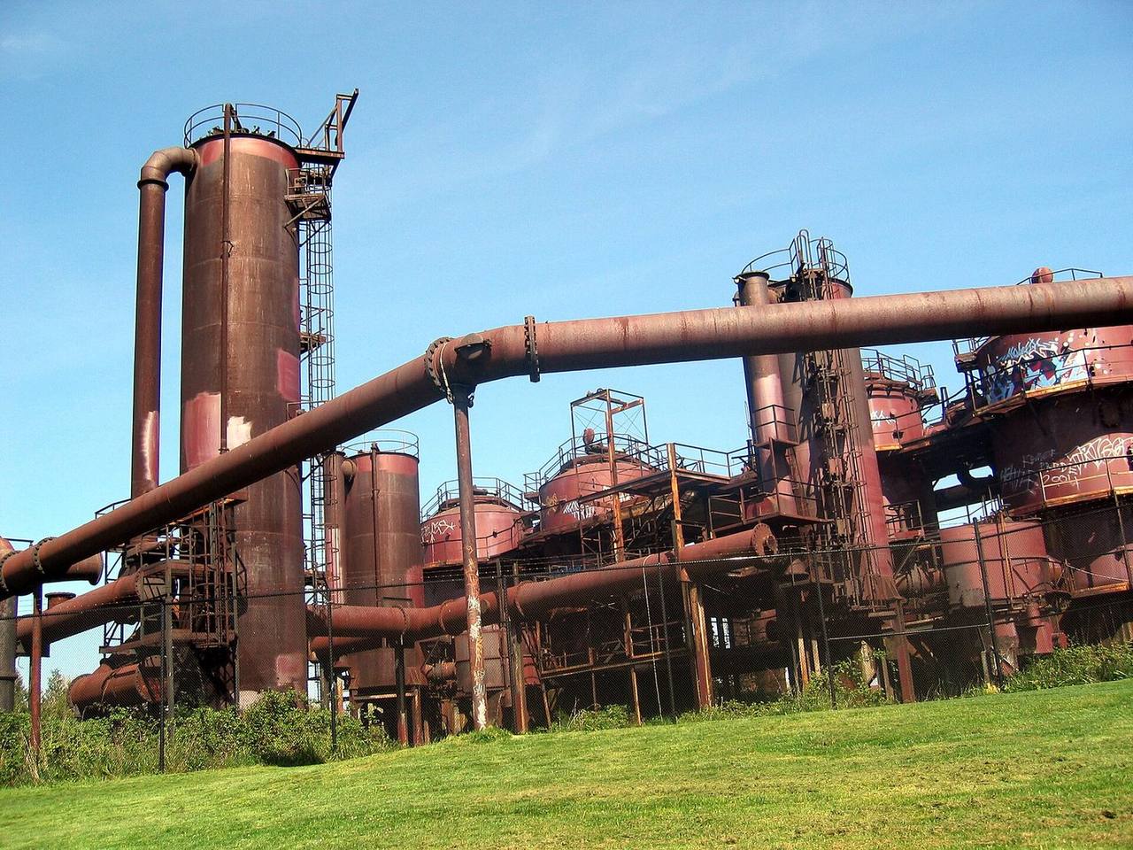
North 45th Street is Wallingford's commercial spine, running east-west with grocery stores, cafes, restaurants, and small shops. Landmarks along and near it include Wallingford Center, housed in a former early-1900s schoolhouse, the QFC with its neon 'WALLINGFORD' sign, and the original Dick's Drive-In, which opened in 1954. Gas Works Park anchors the south end at Lake Union, occupying the site of a former gasification plant and offering open lawns, shoreline access, and mountain and skyline views. Other green spaces include Wallingford Playfield, Meridian Playground, and nearby Lower Woodland Park.
The Burke-Gilman Trail runs along Wallingford's southern edge, providing a paved walking and cycling route that connects toward Fremont and Ballard to the west and the University District to the east. Bus service includes King County Metro Route 44 across the neighborhood and the RapidRide E Line along the Aurora corridor. Wallingford is served by Seattle Public Schools; attendance-area assignments are set by address, and you can confirm the specific schools for any home using the district's Find Your School address lookup.
What buyers & sellers weigh in Wallingford
- Confirm whether a home sits inside the Wallingford-Meridian Streetcar Historic District, which can affect exterior changes.
- Many homes date to the 1920s; budget an inspection focused on foundations, wiring, plumbing, and any prior updates.
- Properties near the Lake Union shoreline may fall within mapped liquefaction-prone or critical areas worth verifying early.
- Ridge-and-slope lots can involve grade, drainage, and retaining-wall considerations to review.
- Parcels near Aurora Avenue North or Interstate 5 carry arterial and freeway proximity to weigh for noise and access.
- Detached houses, townhomes, and small multifamily buildings coexist here, so clarify property type and zoning for your goals.
What makes Wallingford distinct
- A streetcar-suburb street grid with a concentrated, walkable 45th Street business district rather than a mall-style center.
- Direct Lake Union frontage at Gas Works Park and the Burke-Gilman Trail along the southern edge.
- A National Register historic district covering part of the neighborhood, unusual among adjacent areas.
- A central north-Seattle location roughly between Fremont, Green Lake, and the University District, with connecting bus routes.
- A mix of 1920s single-family homes alongside long-standing multifamily buildings in the same neighborhood.
Services in Wallingford
Wallingford real estate FAQ
What kinds of homes are typical in Wallingford?
The neighborhood is known for 1920s-era box houses and Craftsman bungalows, alongside duplexes, townhomes, and apartment buildings, reflecting its origins as an early-1900s streetcar suburb. Property types vary block to block, so I can help you match the right type to your plans.
Which school district serves Wallingford?
Wallingford is served by Seattle Public Schools. Attendance-area assignments are based on your home's address, and you can confirm the specific schools using the district's Find Your School address lookup tool.
What should I check before buying near the Lake Union shoreline?
Homes near the water or on filled ground can fall within the city's mapped liquefaction-prone or shoreline critical areas. I recommend reviewing the City of Seattle's Environmentally Critical Areas maps and getting appropriate inspections as part of your due diligence.
Sources & data
- Wallingford, Seattle - Wikipedia
- Gas Works Park - Wikipedia
- Seattle Neighborhoods: Wallingford - HistoryLink.org
- Seattle Public Schools - Find Your School
- City of Seattle - Updated Liquefaction-Prone Area Map (SDCI)
- Seattle Hazard Explorer (Office of Emergency Management)
- King County Metro RapidRide E Line
- SDOT - Route 44 Transit-Plus Multimodal Corridor