

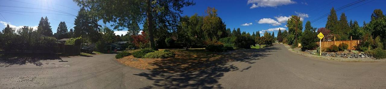
Victory Heights market snapshot
Over the trailing twelve months, the median Victory Heights home sold for about $1,112,500, up 0.1% from a year earlier. Homes here typically went under contract in about 7 days at roughly 100.0% of list price (around $561/sq ft), reflecting a brisk, seller-leaning market. These rolling 12-month figures come from the Northwest Multiple Listing Service, the regional MLS Seattle-area agents list on, as of June 2026, and cover the broader market area around Victory Heights rather than Victory Heights on its own, so for any specific home it is worth comparing recent sales on that block.
About Victory Heights
Victory Heights is a residential neighborhood within the Lake City district of northeast Seattle, roughly bounded by 15th Avenue NE on the west and Lake City Way NE on the east, and spanning the blocks north of NE 98th Street. It sits on an upland between Green Lake and Lake Washington and was annexed into the City of Seattle in 1954.
The neighborhood takes its name from the historic Victory Highway, an early-1920s auto route along its eastern edge that later became Bothell Road and is today Lake City Way NE. Most of the area was subdivided and built out by the Goodwin Company. As with many U.S. neighborhoods platted in that era, early deeds here carried racially restrictive covenants; such covenants have been unenforceable since the 1948 Supreme Court decision in Shelley v. Kraemer and are prohibited under the federal Fair Housing Act.
Want to know what your money actually buys in Victory Heights right now?
Talk it through before you writeHousing & homes
Victory Heights filled in largely during the 1940s and 1950s, and that era still defines its housing stock. You will find a high concentration of mid-century single-family homes, including modest one-story ramblers and story-and-a-half Cape Cod and Minimal Traditional designs typical of postwar Seattle subdivisions, many on generous lots.
Because the neighborhood is close to the city and predominantly detached houses rather than large multifamily complexes, later additions tend to be remodels, expansions, and infill townhomes or accessory dwelling units rather than mid-rise apartment blocks. When you tour here, expect variation in how much each home has been updated from its original postwar footprint.
Local conditions to know
Much of Victory Heights sits on glacial-till uplands, which Seattle's geologic mapping generally associates with a low liquefaction hazard. The exception is the Thornton Creek corridor: the creek runs diagonally through the area, and its ravine and lower-lying stream banks are the kind of drainage- and slope-sensitive land the city regulates under its Environmentally Critical Areas (ECA) ordinance. The creek's path also produces a number of dead-end streets.
If you are buying or selling a property near the creek or on a slope, it is worth checking the parcel against the city's ECA maps early, since steep-slope, riparian, or wetland designations can affect what and how you build. All of Seattle lies in a seismically active region, so standard earthquake and geotechnical due diligence applies. The neighborhood is inland and not on a marine shoreline, so tidal and coastal-flood considerations do not apply here.
Getting around & local texture
The neighborhood's civic anchor is Victory Heights Playground on NE 106th Street, a city park the municipality acquired in 1954 that offers a large grassy field, a loop path, tennis and basketball courts, and a play area rebuilt in 2018 for improved accessibility. Thornton Creek, whose roughly 12-square-mile watershed is the largest in Seattle, threads through Victory Heights on its way from Shoreline toward Lake Washington.
Everyday shopping and services cluster along Lake City Way NE to the east and in the Northgate area to the west, where Sound Transit's Northgate Link light-rail station opened in October 2021 about a mile from the neighborhood. Interstate 5 runs to the west, giving quick freeway access. Victory Heights is served by Seattle Public Schools; families should confirm their address-specific attendance areas using the district's official school-finder tool, as boundaries can change.
What buyers & sellers weigh in Victory Heights
- Verify each home's remodel history: postwar 1940s-50s houses here range from largely original to fully updated, which affects systems, insulation, and price.
- Check any parcel near Thornton Creek against Seattle's Environmentally Critical Areas maps for steep-slope, riparian, or wetland overlays before planning additions.
- Dead-end streets created by the creek corridor affect access, parking, and privacy block to block, so walk the specific street, not just the listing.
- Confirm current Seattle Public Schools attendance areas by address, since assignments and boundaries can change year to year.
- Weigh proximity to the Northgate light-rail station (about a mile) against the fact that stations are a short drive or bus ride, not on-block, for most homes.
- For sellers, understand that this is currently a seller-leaning market within the broader north Seattle area; pricing should reflect your specific block and condition.
- Lot sizes and setbacks can support ADUs or infill; check current Seattle zoning and land-use rules for your parcel before assuming what is buildable.
What makes Victory Heights distinct
- A cohesive pocket of 1940s-50s mid-century homes, distinct from the denser mixed-use redevelopment underway at neighboring Northgate.
- The Thornton Creek corridor runs through the neighborhood, giving it a green, semi-secluded street pattern uncommon in flatter grid areas nearby.
- Positioned between the Lake City Way and Northgate commercial districts, with quick access to both plus Interstate 5.
- Roughly a mile from Northgate Link light rail, tying a quiet residential area to the regional transit spine that opened in 2021.
- Part of the historic Lake City district, annexed to Seattle in 1954, with development tied to the old Victory Highway (now Lake City Way NE).
Services in Victory Heights
Victory Heights real estate FAQ
Where is Victory Heights and what kind of neighborhood is it?
It is a residential neighborhood in northeast Seattle's Lake City district, sitting on an upland between Green Lake and Lake Washington, roughly between 15th Avenue NE and Lake City Way NE north of NE 98th Street. It is primarily a single-family, mid-century neighborhood.
What are homes in Victory Heights typically like?
The area was largely built out in the 1940s and 1950s, so you will see many mid-century single-family houses, including ramblers and Cape Cod and Minimal Traditional styles, often on generous lots. Many have since been remodeled or expanded.
How is transit and commuting access?
Sound Transit's Northgate Link light-rail station, which opened in October 2021, is about a mile away, and Lake City Way NE and Interstate 5 provide road access. Confirm current King County Metro bus routes for your specific address.
Which school district serves Victory Heights?
Victory Heights is served by Seattle Public Schools. Because attendance-area boundaries are set by address and can change, use the district's official school-finder tool to confirm the schools assigned to a particular home.
Sources & data
- Victory Heights, Seattle - Wikipedia
- Thornton Creek - Wikipedia
- Victory Heights Playground - Seattle Parks & Recreation
- Northgate station (Sound Transit) - Wikipedia
- Link light rail reaches U District, Roosevelt and Northgate - Sound Transit
- Find Your School - Seattle Public Schools
- Seattle Environmentally Critical Areas / Geologic Hazard Best Available Science - SDCI
- Updated Liquefaction-Prone Area Map - Seattle Building Connections