

Queen Anne market snapshot
Over the trailing twelve months, the median Queen Anne home sold for about $1,375,000, up 0.2% from a year earlier. Homes here typically went under contract in about 10 days at roughly 100.0% of list price (around $633/sq ft), reflecting a brisk, seller-leaning market. These are rolling 12-month figures for the Queen Anne market, from the Northwest Multiple Listing Service, the regional MLS Seattle-area agents list on, as of June 2026.
About Queen Anne
Queen Anne sits in northwestern Seattle atop and around Queen Anne Hill, covering roughly 2.8 square miles. It is bordered by Belltown to the south, Lake Union to the east, the Lake Washington Ship Canal to the north, and Interbay to the west. Locals often speak of four sub-areas: North, West, and East Queen Anne, plus Lower Queen Anne at the southern base of the hill, which the Seattle City Council formally recognized as Uptown in 2021.
Recent conditions have leaned toward sellers.
Want to know what your money actually buys in Queen Anne right now?
Talk it through before you writeHousing & homes
Named for the Queen Anne architectural style popular in the 1880s, the hill was one of the last Seattle neighborhoods to fully develop, and it retains a large stock of early homes. Concentrations of Queen Anne-style residences from roughly 1890 to 1910 survive in the neighborhood, alongside Craftsman, Tudor, and later 20th-century houses that filled in the slopes over subsequent decades.
Housing types range from detached single-family homes on the hill's residential streets to townhomes and condominiums, with more apartment and mixed-use buildings concentrated in Lower Queen Anne/Uptown near Seattle Center. Many hillside lots are narrow or sloped, and view orientation toward downtown, Elliott Bay, Lake Union, or the Olympic and Cascade ranges is a common differentiator between otherwise similar homes.
Local conditions to know
Queen Anne Hill is one of Seattle's steepest neighborhoods. City records note it holds seven of the twenty steepest streets in Seattle and about 120 pedestrian staircases, so grade, driveway access, and drainage are practical factors when evaluating a specific property. Higher-elevation Seattle hills such as Queen Anne are generally underlain by glacial till and fall outside the city's mapped liquefaction-prone areas, which tend to follow shorelines and low-lying corridors like Interbay; buyers should still consult Seattle's Environmentally Critical Areas maps for steep-slope designations parcel by parcel.
The neighborhood's eastern edge faces Lake Union, home to the Kenmore Air seaplane base, which recorded tens of thousands of aircraft operations annually; properties nearer the water may notice seaplane and float-plane activity. Transit is a defining feature at the base of the hill: the Seattle Center Monorail links Lower Queen Anne to Westlake downtown in about two minutes, and Sound Transit's planned Ballard Link Extension includes a future underground Seattle Center station at West Republican Street and 1st Avenue West, with the downtown-to-Seattle-Center segment funded in 2026 and service planned for 2039.
Getting around & local texture
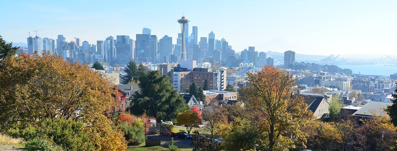
Queen Anne Avenue North, particularly between West Galer and West McGraw Streets, forms the spine of the hilltop business district with shops, restaurants, and services, while Lower Queen Anne/Uptown anchors the neighborhood's arts and entertainment around Seattle Center, the Space Needle, Pacific Science Center, and Climate Pledge Arena. Public open space is a hallmark: Kerry Park offers a well-known viewpoint toward downtown and Mount Rainier, 14-acre Kinnear Park lends wooded trails, and Bhy Kracke Park sits among the hill's residential streets. A loop of streets known as Queen Anne Boulevard, laid out in the tradition of the Olmsted Brothers, rings the crown of the hill.
The neighborhood is served by Seattle Public Schools. Per the district's attendance-area maps, addresses in Queen Anne are assigned to schools including Lincoln High School, whose attendance zone spans Queen Anne and several surrounding neighborhoods. Because Seattle Public Schools assigns students by the address of primary residence and boundaries change over time, confirm the current assignment for a specific address using the district's Find Your School tool.
What buyers & sellers weigh in Queen Anne
- Grade matters: many lots sit on steep slopes, so review driveway access, drainage, and any steep-slope ECA designation.
- Views toward downtown, Elliott Bay, Lake Union, or the mountains can meaningfully affect value between similar homes.
- Older housing stock is common; budget inspection time for foundations, systems, and any updates in early-1900s homes.
- Properties near the eastern (Lake Union) edge may experience seaplane activity from the Kenmore Air base.
- Lower Queen Anne/Uptown offers monorail access and a future planned Seattle Center light-rail station, relevant to both lifestyle and long-term positioning.
- Confirm the current Seattle Public Schools assignment for any specific address, as boundaries can change.
What makes Queen Anne distinct
- A distinct hilltop-plus-flats geography: hillside single-family streets above, and a denser arts-and-entertainment Uptown core at the base near Seattle Center.
- One of Seattle's largest concentrations of early Queen Anne-era architecture, reflecting the neighborhood's late, elite-driven development.
- The Seattle Center Monorail and a planned future Ballard Link light-rail station give Lower Queen Anne unusual transit connectivity to downtown.
- Dramatic topography with the Olmsted-influenced Queen Anne Boulevard, numerous public staircases, and marquee viewpoints like Kerry Park.
- Framed by water and canal on three sides (Lake Union, the Ship Canal) with Interbay to the west, shaping views, access, and edges.
Services in Queen Anne
Queen Anne real estate FAQ
What kinds of homes are in Queen Anne?
The neighborhood mixes detached single-family homes, including many early-1900s Queen Anne-style, Craftsman, and Tudor houses, with townhomes and condominiums. Denser apartment and mixed-use buildings cluster in Lower Queen Anne/Uptown near Seattle Center.
Which school district serves Queen Anne?
Queen Anne is served by Seattle Public Schools. Per the district's attendance maps, addresses here are assigned to schools including Lincoln High School. Because assignments are by address and boundaries change, verify the current school for a specific address with the district's Find Your School tool.
How is Queen Anne connected to the rest of Seattle?
The Seattle Center Monorail links Lower Queen Anne to Westlake downtown in about two minutes, and Sound Transit's planned Ballard Link Extension includes a future Seattle Center station near West Republican Street and 1st Avenue West, with service planned for 2039.
What should I know about the hill's steep terrain?
Queen Anne Hill includes some of Seattle's steepest streets and roughly 120 public staircases. When evaluating a home, review the lot's grade, driveway access, drainage, and whether the parcel carries a steep-slope Environmentally Critical Areas designation on the city's maps.
Sources & data
- Queen Anne, Seattle - Wikipedia
- Lower Queen Anne (Uptown), Seattle - Wikipedia
- Seattle Neighborhoods: Queen Anne Hill Thumbnail History - HistoryLink.org
- Seattle Center Monorail - Wikipedia
- Ballard Link Extension - Wikipedia
- Ballard Link Extension - Sound Transit
- Updated Liquefaction-Prone Area Map - City of Seattle (SDCI)
- ECA - Liquefaction Prone Areas - Seattle GeoData
- Kenmore Air Harbor Seaplane Base (Lake Union) - Wikipedia
- Lincoln High School - Seattle Public Schools
- Find Your School - Seattle Public Schools
- Enrollment Planning Maps - Seattle Public Schools