

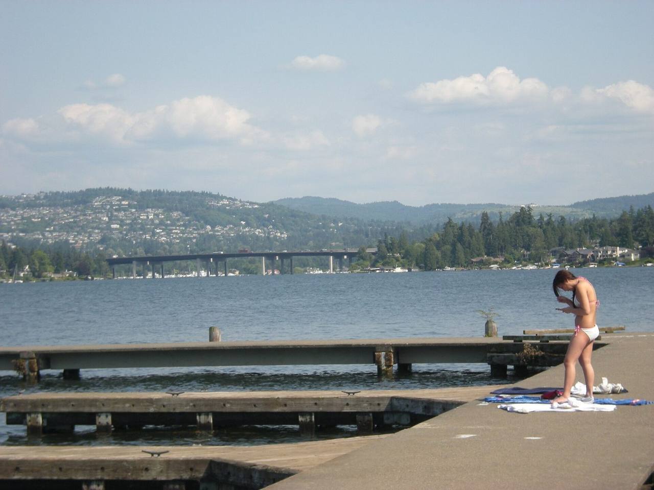
Mercer Island market snapshot
Over the trailing twelve months, the median Mercer Island home sold for about $2,498,000, up 1.2% from a year earlier. Homes here typically went under contract in about 11 days at roughly 97.6% of list price (around $784/sq ft), reflecting a market that has cooled toward balance. These are rolling 12-month figures for the Mercer Island market, from the Northwest Multiple Listing Service, the regional MLS Seattle-area agents list on, as of June 2026.
About Mercer Island
Mercer Island is a city in King County occupying an island of the same name in the southern portion of Lake Washington, positioned between Seattle to the west and Bellevue to the east. The U.S. Census Bureau reports a total area of about 12.9 square miles, of which roughly 6.4 square miles are land and the remainder is water; the population was 25,748 at the 2020 census.
The island was incorporated as a city in 1960, and the city and the separate business-district town merged into today's City of Mercer Island in 1970. It operates under a council-manager form of government. As a whole-island jurisdiction, it is distinct from most Eastside and north-end communities: its only vehicle access is by Interstate 90.
Want to know what your money actually buys in Mercer Island right now?
Book a call and I'll tell you what I'd doHousing & homes
Most of Mercer Island's housing was built between the 1950s and the 1970s. Reporting and local records describe a mix that includes mid-century ramblers, Northwest Contemporary designs, and larger custom contemporary homes, alongside older waterfront properties and planned subdivisions laid out largely in the 1960s and 1970s. The city is predominantly a single-family market, with several thousand detached homes.
The city's single-family zoning is organized into districts such as R-8.4, R-9.6, R-12, and R-15, each setting minimum lot size, setbacks, and related standards; buyers should confirm the zone and its limits for any specific parcel. Waterfront lots range from high-bank to low-bank, which affects beach access and the permitting path for docks and shoreline structures.
Local conditions to know
Mercer Island regulates several geological critical areas that can affect development. The city's code addresses landslide, steep-slope, erosion, and seismic hazard areas; erosion-hazard sites carry a seasonal limit on land clearing, grading, filling, and foundation work between October 1 and April 1, and sites in mapped hazard areas can require a geotechnical report. Steeper slopes and larger mapped landslide areas are more common around the island's periphery and its southern and eastern sides.
The island lies within the Seattle Fault Zone, and the city maintains seismic-hazard mapping for the island. Because the shoreline is extensive, many parcels also fall under shoreline regulations that govern bulkheads, docks, and near-water work. Vehicle access is entirely by Interstate 90, which crosses the island via the Lacey V. Murrow and Homer M. Hadley bridges to Seattle and the East Channel Bridge to Bellevue.
Getting around & local texture
Mercer Island's commercial core is its Town Center, near the north end of the island. Mercerdale Park sits in the heart of Town Center, and Luther Burbank Park, a roughly 77-acre regional park on the northeast end, offers Lake Washington shoreline, trails, a swimming area, and a boat dock and fishing pier. The city notes multiple public waterfront parks and a public boat launch that provide shoreline access around the island.
Transit access changed in 2026: the Sound Transit 2 Line light rail Mercer Island Station opened on March 28, 2026, located in the median of Interstate 90 near the Town Center business district, adjacent to a park-and-ride garage. Public schools are served by the Mercer Island School District (District 400), whose elementary schools include Island Park, Lakeridge, Northwood, and West Mercer, with Islander Middle School and Mercer Island High School serving upper grades; families should verify assignment against the district's published boundary maps for a specific address.
What buyers & sellers weigh in Mercer Island
- Confirm the parcel's single-family zoning district (for example R-8.4 through R-15) and its lot-size, setback, and height limits before planning a build or addition.
- For waterfront property, determine whether it is high-bank or low-bank, and review shoreline rules governing docks, bulkheads, and near-water work.
- Order a geotechnical review where a site touches mapped landslide, steep-slope, erosion, or seismic hazard areas.
- Plan grading and foundation timing around the October 1 to April 1 seasonal work limit that applies to erosion-hazard sites.
- Factor in that all vehicle access is via Interstate 90, and that the 2 Line light rail station near Town Center opened in 2026.
- Verify school assignment against the Mercer Island School District boundary maps for the exact address, since attendance areas are set by boundary.
- Because the island is a single, compact city market, comparable sales can be limited within a narrow home type or waterfront segment, so widen the comparison thoughtfully.
What makes Mercer Island distinct
- Mercer Island is a whole-island city in Lake Washington, with vehicle access only via Interstate 90, unlike its mainland Eastside and Seattle neighbors.
- A 2 Line light rail station opened in the I-90 median near Town Center in March 2026, adding a rail connection between Seattle and Bellevue.
- The market is predominantly single-family, with much of the stock dating from the 1950s through the 1970s and a distinct waterfront segment.
- Extensive Lake Washington shoreline and city-regulated geological critical areas make site conditions and permitting central to many transactions.
- The island is served by its own school district (Mercer Island School District 400) with a single public middle school and high school.
Services in Mercer Island
Mercer Island real estate FAQ
How do you get to and around Mercer Island?
The only vehicle access is Interstate 90, which crosses the island on the Lacey V. Murrow and Homer M. Hadley bridges toward Seattle and the East Channel Bridge toward Bellevue. Since March 2026, the Sound Transit 2 Line light rail also stops at the Mercer Island Station in the I-90 median near Town Center, next to a park-and-ride garage.
What kinds of homes are on Mercer Island?
The market is predominantly single-family. Much of the housing was built from the 1950s through the 1970s, and the mix includes mid-century ramblers, Northwest Contemporary homes, larger custom contemporary houses, and a distinct waterfront segment ranging from high-bank to low-bank lots.
What site conditions should buyers check before purchasing?
The city regulates landslide, steep-slope, erosion, and seismic hazard areas, and the island sits within the Seattle Fault Zone. For hazard-area or waterfront parcels, review whether a geotechnical report is needed, note the October 1 to April 1 seasonal work limit for erosion-hazard sites, and confirm shoreline rules for any dock or bulkhead work.
Which school district serves Mercer Island?
Mercer Island is served by the Mercer Island School District (District 400). Its elementary schools include Island Park, Lakeridge, Northwood, and West Mercer, with Islander Middle School and Mercer Island High School serving upper grades. Attendance is set by boundary, so verify assignment against the district's boundary maps for a specific address.
Sources & data
- Mercer Island, Washington - Wikipedia (geography, history, incorporation, I-90 access, population)
- City of Mercer Island incorporates on July 5, 1960 - HistoryLink.org
- Geological Hazards - City of Mercer Island (landslide, steep slope, erosion, seismic; seasonal work limit)
- Mercer Island Seismic Hazard Assessment - City of Mercer Island
- Interstate-90 Issues - City of Mercer Island (sole access via I-90)
- Mercer Island Station - Sound Transit (2 Line project summary)
- Historic Station Opening Marks Start of Light Rail Service on Mercer Island - City of Mercer Island
- Mercer Island station - Wikipedia (opened March 28, 2026; I-90 median; park-and-ride)
- Luther Burbank Park - City of Mercer Island (77 acres, shoreline, docks, trails)
- Mercer Island Comprehensive Plan Housing Element (housing built 1950s-1970s, unit counts)
- Property Research and Historic Zoning Codes and Maps - City of Mercer Island (single-family zones)
- Boundary Maps - Mercer Island School District 400
- Geological map shows more hazards for Mercer Island - The Seattle Times (Seattle Fault Zone, slopes)