

Magnolia market snapshot
Over the trailing twelve months, the median Magnolia home sold for about $1,375,000, up 0.2% from a year earlier. Homes here typically went under contract in about 10 days at roughly 100.0% of list price (around $633/sq ft), reflecting a brisk, seller-leaning market. These are rolling 12-month figures for the Magnolia market, from the Northwest Multiple Listing Service, the regional MLS Seattle-area agents list on, as of June 2026.
About Magnolia
Magnolia is a large residential neighborhood on a hilly peninsula in northwest Seattle, set between Salmon Bay and Shilshole Bay to the north and Puget Sound and Elliott Bay to the west and south. It has been part of the city since 1891, and Captain George Davidson of the U.S. Coast Survey is credited with naming it in 1856 after mistaking the area's madrona trees for magnolias.
The peninsula connects to the rest of Seattle across the BNSF Railway tracks by way of three bridges: W. Emerson Street to the north, W. Dravus Street through the center, and the W. Garfield Street bridge, known since 1960 as the Magnolia Bridge, to the south. To the east, Magnolia is bounded by the rail corridor and the Port of Seattle's Terminal 91, with the Interbay area beyond.
Want to know what your money actually buys in Magnolia right now?
Get a straight read on your optionsHousing & homes
Magnolia developed largely as a single-family residential area, with much of its housing dating to the 1920s and 1930s, when many homes were built on the hillsides after the Garfield Street (Magnolia) Bridge opened in 1930 and the Dravus Street Bridge opened in 1931. You will find a broad range of period architecture across the neighborhood, from earlier bungalows and Tudor-influenced houses to mid-century homes and later infill and remodels.
Detached single-family homes are the dominant property type across most of Magnolia, including lots that take advantage of the bluff for Puget Sound and Olympic Mountain outlooks.
Local conditions to know
Magnolia's peninsula setting makes several physical conditions central to any purchase. Steep slopes and high bluffs edge the west and south sides above Puget Sound, and Seattle designates landslide-prone, steep-slope, and liquefaction-prone areas as Environmentally Critical Areas under its land use code, which can affect what and how you build. Magnolia has a documented landslide history, with concentrations along Perkins Lane to the west and other bluff slopes; the West Point shoreline and beaches lie within Discovery Park. If you are considering a slope or waterfront-adjacent property, order geotechnical review and confirm ECA status early.
Access and infrastructure are also worth weighing. The Magnolia Bridge is more than nine decades old and appears on SDOT's list of structurally deficient bridges; the city has a planning study for its future but has not secured funding for replacement, and it is monitored and inspected on an ongoing basis. Bridge maintenance or closures can affect travel times between Magnolia and the rest of the city. The eastern edge borders an active rail corridor and port terminal.
Getting around & local texture
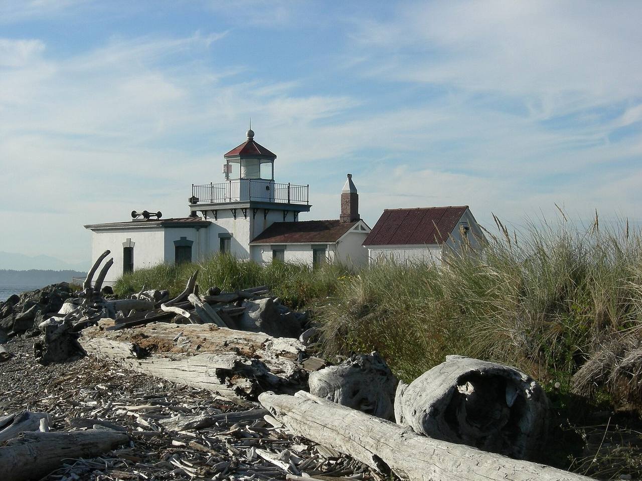
Daily life centers on Magnolia Village along W. McGraw Street and 34th Avenue W., a compact business district with a bookstore, cafes, restaurants, and a grocery store, plus the Magnolia Community Center at 2550 34th Avenue W. and a seasonal Saturday farmers market. Discovery Park, Seattle's largest park at roughly 560 acres on the former Fort Lawton site, occupies the northwest of the peninsula with beaches, meadows, forest, sea cliffs, and the historic West Point Lighthouse; the park's visitor center has been closed following a 2025 water-main flood.
Magnolia is served by King County Metro bus routes, including Route 24 (West Magnolia), Route 31, Route 32, and Route 33 (Discovery Park/East Magnolia); there is no light rail station in Magnolia, and Sound Transit's current Ballard Link plan routes through Interbay rather than the peninsula itself. Magnolia is within the Seattle Public Schools district, which assigns students to schools by residential attendance-area boundaries; public schools located in the neighborhood include Lawton Elementary, Magnolia Elementary, and Catharine Blaine K-8. Confirm your specific assignment on the district's attendance-area map before relying on it.
What buyers & sellers weigh in Magnolia
- For west- and south-side properties near the bluff, budget for geotechnical review and confirm whether the lot falls within a mapped Environmentally Critical Area (steep slope, landslide, or liquefaction).
- Factor the Magnolia Bridge's age and uncertain replacement timeline into how you value commute reliability, since the three bridge crossings are the peninsula's only road links.
- Verify your assigned Seattle Public Schools attendance area on the district boundary map, as it drives school assignment by address.
- Homes with Puget Sound or Olympic views often sit on or above the bluff; review slope stability, drainage, and any past slide activity as part of due diligence.
- Confirm transit fit early: Magnolia relies on Metro bus routes rather than light rail, which matters for commute planning.
- Sellers on the bluff should gather geotech, drainage, and any prior stabilization records in advance, since buyers and lenders frequently ask for them.
What makes Magnolia distinct
- A large single-family peninsula bounded by water on three sides and by rail and the Port of Seattle to the east, unlike its denser, more mixed neighbor Queen Anne.
- Home to Discovery Park, Seattle's largest park, with beaches, sea cliffs, and the West Point Lighthouse on the former Fort Lawton grounds.
- Access defined by three bridges over the BNSF tracks, including the aging Magnolia Bridge, which makes bridge conditions a distinctive local factor.
- Bluff and steep-slope geography with a documented landslide history along the western shoreline, notably Perkins Lane.
- A self-contained walkable core, Magnolia Village, on W. McGraw Street and 34th Avenue W.
Services in Magnolia
Magnolia real estate FAQ
What kind of homes are in Magnolia?
Magnolia is predominantly a single-family neighborhood, with much of its housing built in the 1920s and 1930s after the Magnolia and Dravus Street bridges opened. Styles range from early bungalows and Tudor-influenced houses to mid-century homes and newer remodels, including bluff-side lots with Puget Sound and Olympic Mountain outlooks.
How do you get to and around Magnolia?
The peninsula connects to the rest of Seattle over the BNSF rail tracks by three bridges: W. Emerson Street, W. Dravus Street, and the Magnolia Bridge. King County Metro serves the area with routes including 24, 31, 32, and 33. There is no light rail station in Magnolia; Sound Transit's current Ballard Link plan runs through Interbay instead.
Are landslides or steep slopes a concern in Magnolia?
Parts of Magnolia sit on high bluffs above Puget Sound, and the neighborhood has a documented landslide history, especially along Perkins Lane to the west. Seattle maps landslide-prone, steep-slope, and liquefaction-prone areas as Environmentally Critical Areas, so a geotechnical review and an ECA check are worthwhile for slope or waterfront-adjacent properties.
What school district serves Magnolia?
Magnolia is within Seattle Public Schools, which assigns students by residential attendance-area boundaries. Public schools located in the neighborhood include Lawton Elementary, Magnolia Elementary, and Catharine Blaine K-8. Check the district's attendance-area map to confirm the assignment for a specific address.
Sources & data
- Magnolia, Seattle - Wikipedia
- Seattle Neighborhoods: Magnolia - Thumbnail History (HistoryLink)
- Discovery Park - Seattle Parks and Recreation
- Environmentally Critical Areas (ECA) Code - Seattle SDCI
- Magnolia Bridge Planning Study - Seattle Department of Transportation
- Magnolia Elementary - Seattle Public Schools
- Ballard Link Extension - Sound Transit
- 24 - West Magnolia bus route - King County Metro